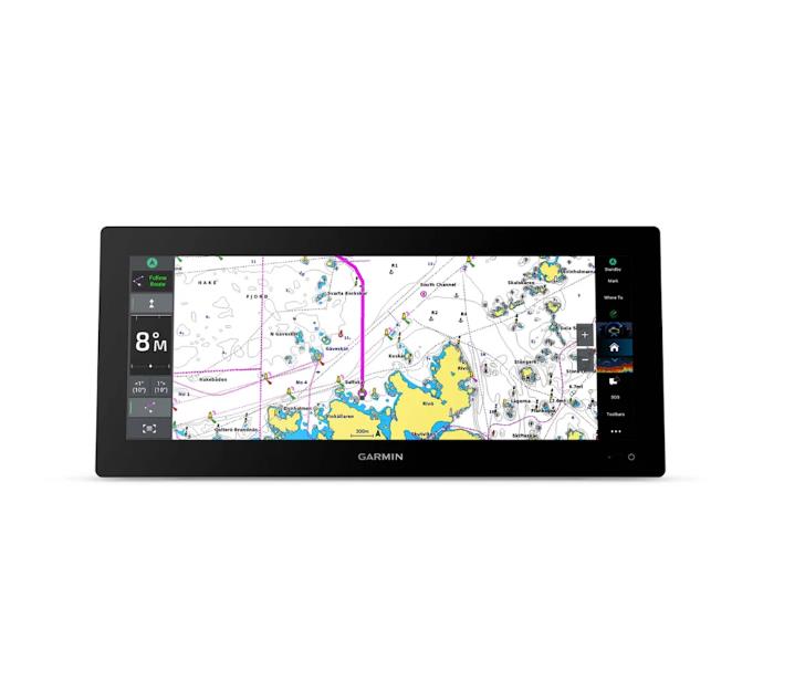
Garmin ECHOMAP UHD2 9” Charplotter 92sv without Transducer
€1149.99
Product is orderable

-
1.3
-
10,4″ x 6,5″ x 3,2″ (26,4 x 16,6 x 8 cm)
-
7,8″ x 4,5″, 9″ (19,8 x 11,5 cm, 22,9 cm)
-
1024 x 600 pixels
-
WSVGA, TN
-
1300.00
-
IPX7
-
microSD (32GB)
-
5000
-
50000
-
50 saved tracks
-
100
-
10 Hz
-
Yes
-
True
-
True
-
True
-
True
-
True
-
True
-
True
-
True
-
True
-
Built-in (single channel CHIRP, 50/77/83/200 kHz, L, M, H CHIRP)
-
500 W
-
Built-in 260/455/800/1000/1200 kHz
-
True
-
9–18 Vdc
-
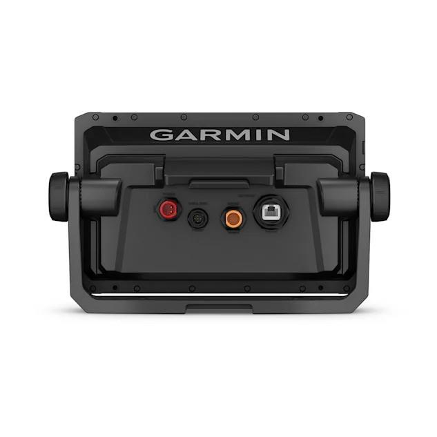
12-pin transducer ports: 1
KNOW THE LOCAL WATERS EXCELLENT
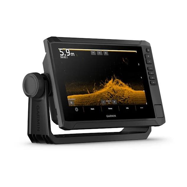
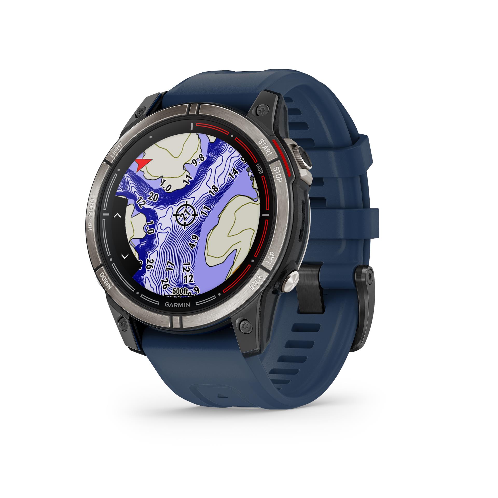
The saying goes, “Talk to a local.” With the ECHOMAP UHD2 chartplotter, which features best-in-class sonar and mapping, plus a premium touchscreen display with additional button support, you’ll know the waters better than they do.
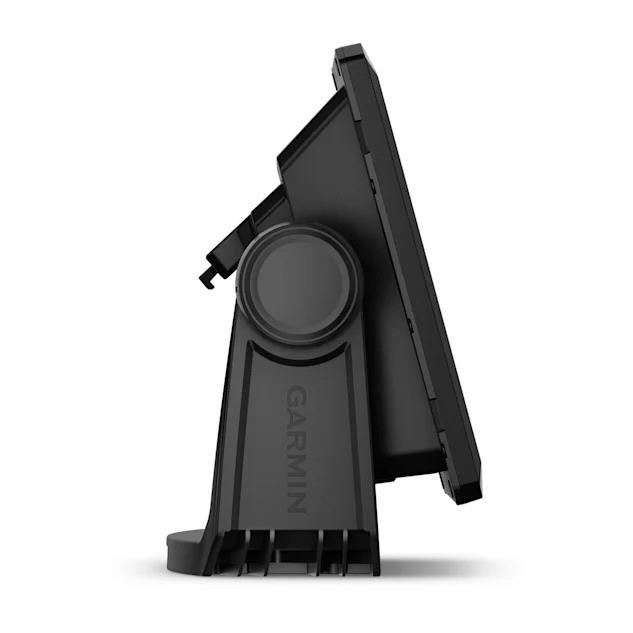
- The bright 9″ touchscreen display with additional button support is user-friendly and easy to read.
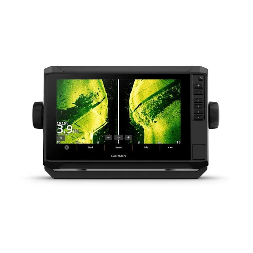
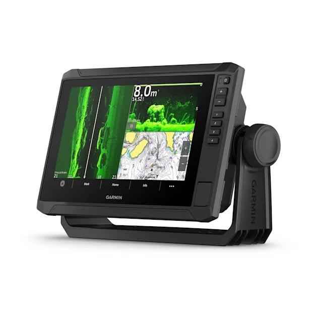
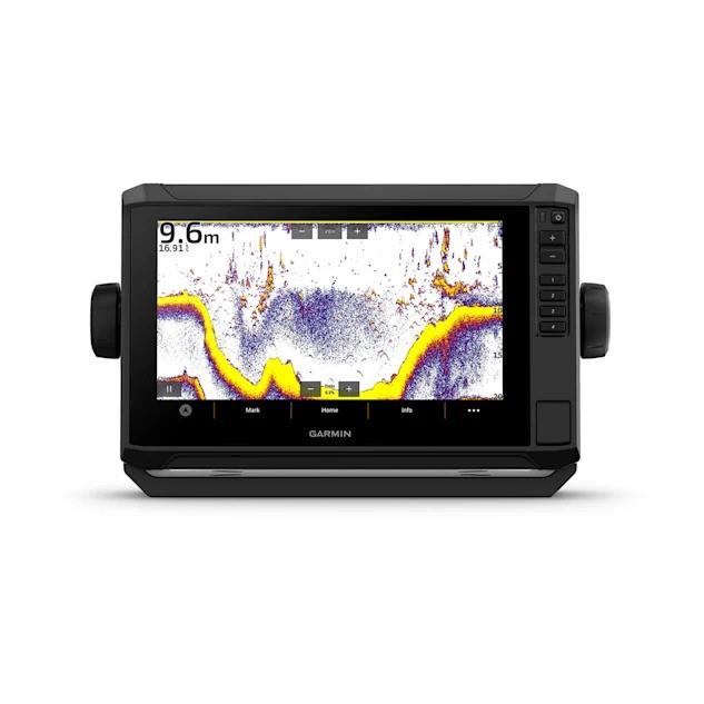
- Good things come in threes. Three types of sonar: Garmin traditional, ClearVü™ and SideVü™ sonars.
- Improved detail? Yes. Better target separation? Yes. That’s the benefit of the high-contrast, bright color palette.
- If you’re using another ECHOMAP UHD2 chartplotter, you can wirelessly share sonar data, waypoints and routes.
- Want the best maps? Who doesn’t? Discover the vast expanse of water with Garmin Navionics+™ charts.
It doesn’t get any better than this.
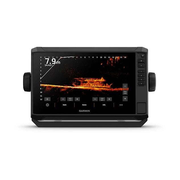
SONAR SUPPORT
With crisp, clear traditional sonar and superior ClearVü and SideVü scanning sonar, fish will have nowhere to hide. Your ECHOMAP UHD2 also supports LiveScope™ live scanning sonar.
VIBRANT COLOR PALETTES
High-contrast, vibrant scanning sonar color palettes make it even easier to distinguish targets and terrain.
CONNECT TRANSDUCERS
Your ECHOMAP UHD2 supports a variety of Garmin transducers. The 6″ and 7″ chartplotters are available with the GT54 transducer, and the 9″ chartplotters are available with the GT56 transducer.
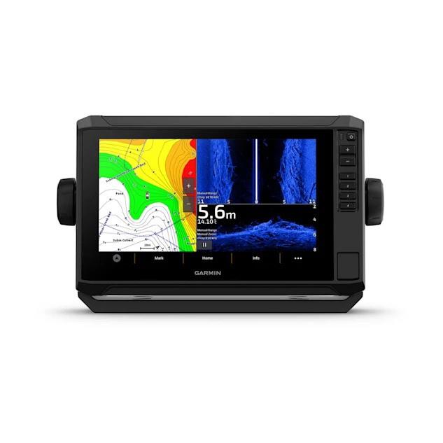
ADD WATER MAPS
Enjoy unparalleled coverage and detail with Garmin Navionics+ additional integrated charts or Garmin Navionics Vision additional premium charts with high-resolution terrain shading, satellite imagery, sonar imagery and more. These charts come with a 1-year subscription for downloadable daily updates.
WIRELESS NETWORKING
If you have another compatible ECHOMAP UHD2 chartplotter on your boat, you can wirelessly share information like sonar data1, waypoints and routes with them.
ACTIVECAPTAIN® APP
Built-in Wi-Fi® connectivity for free pairing with the feature-rich mobile app for access to OneChart™, smart notifications2, software updates, Garmin Quickdraw Community data and more.
AUTO GUIDANCE+™ TECHNOLOGY
Chartplotters with built-in Garmin Navionics+ charts include downloadable Auto Guidance+ technology3 with the ActiveCaptain app.
FISH WITH FORCE®
ECHOMAP UHD2 wirelessly connects to your Force trolling motor to create and follow routes, provide navigational guidance to waypoints, monitor speed, check battery life, and more.
POWER-POLE® SHOULD-WATER ANCHOR
By networking select Garmin chartplotters with Force® trolling motors and a compatible Power-Pole shallow-water anchor system, you can access additional boat control features4 from your chartplotter, including Smart Anchor Auto Drop, Smart Anchor Steering, Auto Positioning, Anchor Drag Detection, and Auto Drop5 at the End of a Route. Spend more time fishing and less time positioning.
CHARGE INTEGRATION FROM POWER-POLE
The CHARGE Marine Power Manager from Power-Pole integrates with compatible Garmin chartplotters to help your battery last longer and perform better on the water. You can charge batteries on the move, monitor power usage, choose where to direct power, control emergency starting, and even transfer power between power stores, all from your chartplotter display.
MULTI-BAND GPS
Get improved position accuracy with multi-band GPS, especially in areas with reflected or weak signals.
Same brand products
Relation products